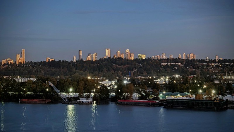
Looking down from the balcony on Carnarvon Street, the river feels surprisingly hemmed in. From the foot of Sixth Street across to the quiet stretch of park off Tannery Road in Surrey, the water spans barely over five hundred metres bank to bank. The bluff's steep elevation deceives the eye, compressing that half-kilometre gap until the opposing shoreline looks almost within arm's reach. The water feels compressed. Bulkheads, wharves, and industrial docks funnel the Fraser into a tight, muscular throat. That urban pinch only magnifies the raw power moving through it, draining a quarter of British Columbia from a watershed larger than the whole of Great Britain. Even here, thirty-five kilometres inland from the ocean, the Pacific pushes back with a heavy twice-daily tide, driving saltwater beneath an average outgoing torrent of thirty-five hundred cubic metres of silt every second.
That relentless volume makes it an irreplaceable biological artery. Millions of returning wild salmon (chinook, sockeye, coho, pink, and chum) funnel through this narrow gap every year, fighting their way past our pier toward interior spawning beds that can lie more than a thousand kilometres upstream near the Rocky Mountains. Down in the murky sediment below the shipping channel, prehistoric white sturgeon continue to patrol the riverbed, some living over a century and growing several metres in length. The river never stops working.

Indigenous communities lived and fished along this waterway for thousands of years, respecting both the dangerous current and the massive salmon runs it carried. When outside explorers finally tried navigating it by boat, they quickly learned the hard way that the churning canyons upstream were nearly suicidal to travel. Then came the 1858 gold rush. Thousands of miners poured in practically overnight, turning this violent river into the only practical supply highway into the interior. A permanent settlement had to be established quickly near the river mouth to collect taxes, maintain law, and guard the border.
The surveyors chose this exact spot because of its geography. Flatter ground farther upstream was rejected because it sat low and defenseless. This north bluff offered high ground with a clear view down the channel, backed by deep water where ocean ships could tie up right against the bank. The military blasted through massive timber to lay out the steep hillside streets we walk today. Because this was the narrowest practical place to cross the lower river, that decision eventually funnelled the current three major bridges straight into downtown. Even after the political capital was shifted over to Vancouver Island a few years later, the riverfront stayed busy. The docks, timber mills, and railways remained right here because the physical geography made sense.

Living alongside this rushing channel for three decades has never dimmed our appreciation of its quiet majesty nor its daily importance. The light still catches the silty boils in unexpected ways at dusk, and the deep horn of an outbound tug continues to command our attention as it clears the bridge pilings. Skylines grow taller, seasons cycle through, and shipping schedules shift, but the brown water keeps paying the freight.